
Map collection
The National Library's Map Collection contains approximately 1, 300 maps (as at June 2020), forming a historically and culturally significant entity. Besides legal deposit copies, the Collection has been augmented by donations and through purchases. The National Library’s map collection comprises of topographic maps, city plans and thematic maps and is used by a variety of people for the study of history, genealogy, geography, agriculture, town planning and environmental studies. Bibliographical information of the maps held by the National Library is accessible via our OPAC.
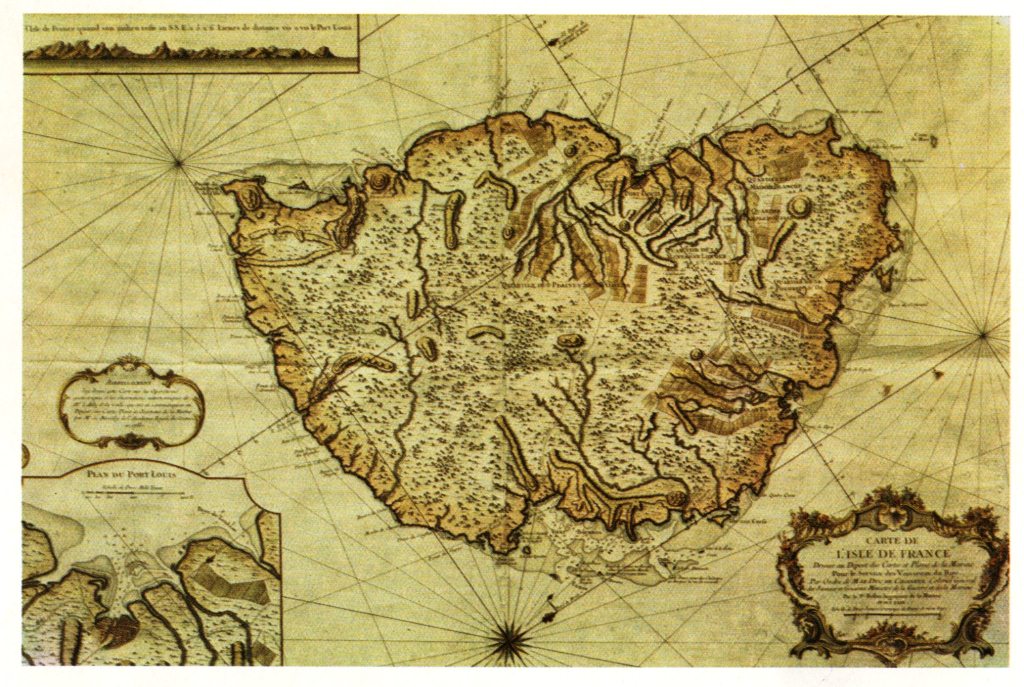 Map of Isle de France, drawn up in 1763 at the Office of sea charts and plans for the service of the King’s vessels
Source : Mauritius : Isle de France en mer indienne